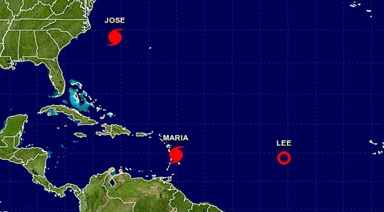
Here we go again. It’s stating the obvious to say that no one wants to deal with another storm, but here we are. At this point, the only thing we can hope is that Maria stays far enough south of the Sint Maarten/Saint Martin that the impact to the island is minimal.
Hurricane #Maria Advisory 9: Maria Rapidly Intensifies Into a Major Hurricane. https://t.co/VqHn0uj6EM
— NHC Atlantic Ops (@NHC_Atlantic) September 18, 2017
Here is the latest information from the National Hurricane Center.
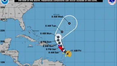
Maria has intensified into a category three hurricane. Winds are sustained at 120 mph (195 km/hr) and the storm is located at a longitude 14.7N and latitude 60.1W moving west/northwest at 10 mph. The slow moving nature of the storm contributes to it’s ability to continue to strengthen as it moves. In addition, slow moving storms have a tendency to cause more intense flooding with higher rainfall amounts due to the extended exposure to the storm.
Sint Maarten and Saint Martin are both under a hurricane watch. Per the NOAA’s National Hurricane Center, a Hurricane Watch means that hurricane conditions are possible within the watch area. A watch is typically issued 48 hours before the anticipated first occurrence of tropical-storm-force winds, conditions that make outside preparations difficult or dangerous.
In addition, Sint Maarten is now under a tropical storm warning. A Tropical Storm Warning means that tropical storm conditions are expected somewhere within the warning area.
Hurricane conditions are possible on the island Tuesday through Wednesday, with tropical storm conditions possible later today or tonight. Storm surge is expected to be 6 to 9 feet in the hurricane warning area.
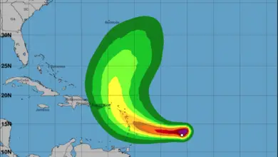
Maria is also expected to produce total rain accumulations of 2 to 4 inches with isolated maximum amounts of 8 inches over the remaining northern Leeward Islands from Barbuda to Anguilla. The rainfall could cause life-threatening flash floods and mudslides.
Click here for the full advisory from the NHC.


